Digital Twin
 A digital twin of an urban watershed is a dynamic virtual representation of a real urban watershed. It integrates various data sources, models, and analytics to mirror the physical watershed and simulate its behavior under different conditions.
Here’s a breakdown of what that entails:
Digital Representation
It’s a computer-based model that includes the physical components of the urban watershed, such as:
- Terrain and topography: Representing the land surface and its slopes.
- Water bodies: Rivers, streams, lakes, wetlands, and groundwater aquifers.
- Infrastructure: Stormwater drainage systems (pipes, culverts, ditches), water treatment plants, reservoirs, and other relevant built structures.
- Urban development: Buildings, roads, parking lots, and other impervious surfaces that significantly impact water flow.
- Green spaces: Parks, vegetation, and pervious areas that influence infiltration and runoff.
Data Integration
It pulls together real-time and historical data from various sources, including:
- Sensors: Monitoring rainfall, streamflow, water quality, soil moisture, and other environmental parameters.
- Remote sensing: Satellite and aerial imagery providing data on land cover, vegetation health, and water extent.
- Geographic Information Systems (GIS): Spatial data on infrastructure, land use, and administrative boundaries.
- Operational data: Information from water management facilities.
- Weather forecasts: Predicting future precipitation and temperature.
Simulation Models
It incorporates hydrological and hydraulic models to simulate various processes within the watershed, such as:
- Rainfall-runoff processes: Predicting how precipitation translates into surface runoff.
- Water flow: Modeling the movement of water through rivers, streams, and the stormwater network.
- Water quality: Simulating the transport and transformation of pollutants.
- Groundwater flow and recharge.
- Impact of land use changes and climate change scenarios.
Analytics and Visualization
It uses analytical tools and visualization techniques to:
- Monitor current conditions: Providing a real-time understanding of the watershed’s state.
- Forecast future conditions: Predicting potential floods, droughts, or water quality issues.
- Assess the impact of different scenarios: Evaluating the effectiveness of various management strategies or infrastructure changes.
- Communicate insights: Presenting complex information in an understandable format for decision-makers and stakeholders.
In essence, a digital twin acts as a virtual laboratory for an urban watershed, allowing for experimentation, analysis, and informed decision-making without directly manipulating the real environment.
Applications of Digital Twins in Urban Watershed Management:
Flood Management
Simulating flood events, assessing vulnerability, and optimizing the design and operation of flood control infrastructure.
Water Quality Management
Predicting pollutant transport, identifying sources of contamination, and evaluating the effectiveness of mitigation measures.
Stormwater Management
Optimizing the design and operation of green infrastructure and drainage systems to reduce runoff and pollution.
Water Resource Management
Assessing water availability, simulating the impact of droughts, and optimizing water allocation strategies.
Infrastructure Planning
Evaluating the performance of existing infrastructure and planning for future upgrades or expansions.
Climate Change Adaptation
Assessing the impacts of climate change on the watershed and developing adaptation strategies.
Stakeholder Engagement
Providing a platform for visualizing and understanding complex water management issues, facilitating collaboration among different stakeholders.
By providing a comprehensive and dynamic understanding of urban watersheds, digital twins are becoming powerful tools for creating more resilient, sustainable, and livable cities.
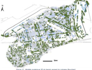
Our Lead partner in development of a digital twin of the Bouchard creek watershed is:
LAVAL UNIVERSITY
Mir Abolfazl Mostafavi, Ing., PhD.
Full Professor, Department of Geomatics, Université Laval
Canada Research Chair in Intelligent and Inclusive Cities and Mobility
Editor-in-Chief of the journal GEOMATICA
President of the Canadian Institute of Geomatics (CIG)
Regular researcher at the Centre for Research in Data and Geospatial Intelligence (CRDIG)
Regular researcher at the Centre for Interdisciplinary Research in Rehabilitation and Social Integration (CIRRIS)