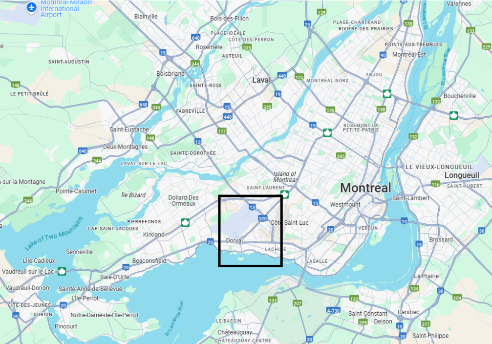
Where We Are
The Bouchard creek is located in the city of Dorval on the island of Montreal, Quebec, flowing south from Pierre Elliott Trudeau International Airport to the St-Lawrence River at Dorval’s picturesque Millenium park. The watershed area that feeds the Bouchard creek includes most of the airport, Dorval’s industrial zone and its southeastern residential zone. The watershed also extends east into Lachine and northeast into Arrondissment Saint-Laurent.
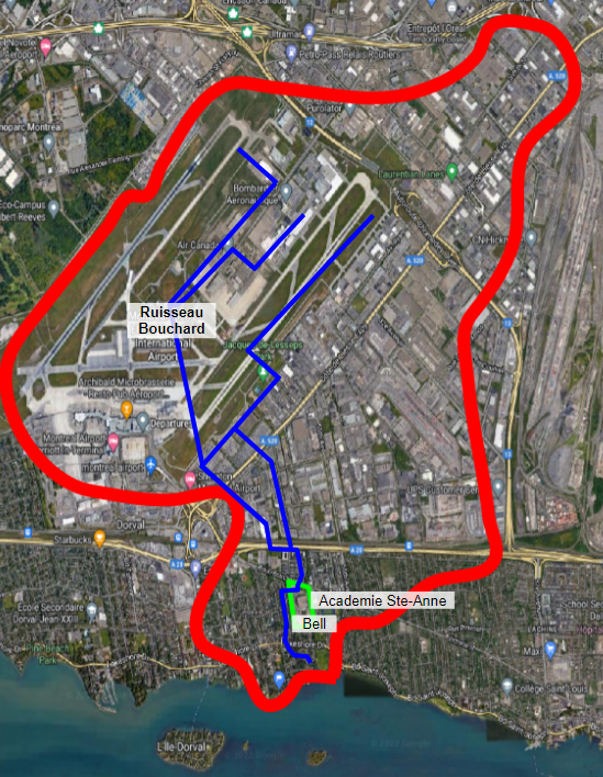
The Bouchard Creek Watershed
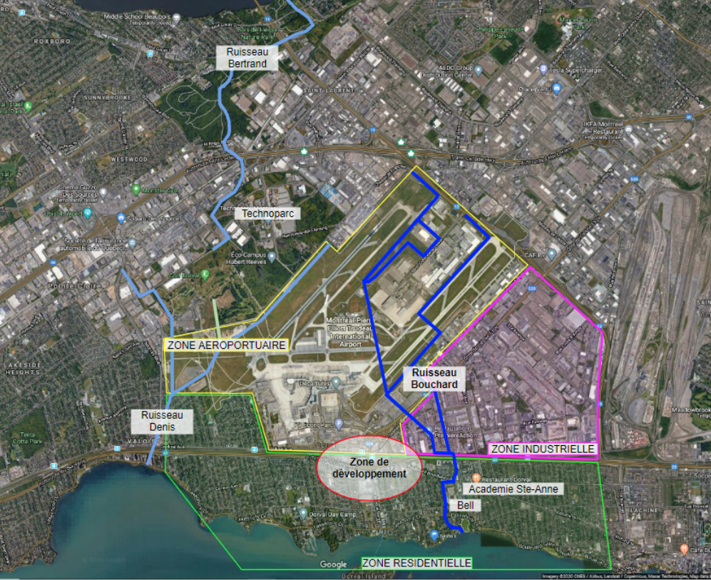
Zones and neighboring creeks
Self-guided Tour
Tourist guide for Bouchard Creek
Welcome to our guided tour for exploring the Bouchard Creek, a place of tranquillity and natural beauty hidden in Dorval, waiting to be discovered!
Residential Section
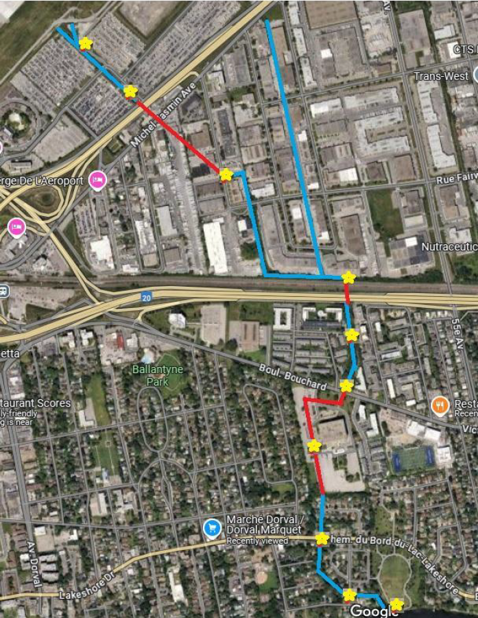
We begin our adventure at the Bell Building car park, located at 200 Bouchard Boulevard, a convenient place to park your car and start your exploration. This car park overlooks Bouchard Creek, an area that the Bouchard Creek Foundation would like to highlight and encourage redevelopment to reveal its full splendour.
Across Bouchard Boulevard, you will come to a small bridge and the entrance to Park Mousseau-Vermette, a charming path along the Bouchard creek awaits you. This path, which winds between the residences and the water, leads you until it passes under Highway 20.
On the other side of the creek, Galland Boulevard provides access to other fascinating viewpoints. If you cross Bouchard Boulevard again, you will discover the Sainte-Anne schools to the east, which are conducting exciting projects to study and preserve this precious waterway.
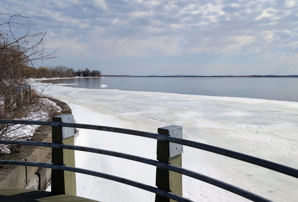
The creek remains underground until it exits at the south end of 200 Bouchard, into a residential area. The creek is only visible from road overpasses until it reaches Millennium Park, where it flows into the St. Lawrence river. This picturesque section of the waterway is the most popular with visitors, offering easy access to the banks and an ideal atmosphere for a break in the heart of nature.
Industrial Section
To explore the industrial section of the creek, it is advisable to pass under Highway 20 via 55th Avenue. Turn left on Guthrie Avenue, then left again on Meloche Avenue, where you will find several parking spaces nearby. The creek is visible along the railway line, but access to the water is difficult.
After this section, the creek goes north underground again going under Cote de Liesse towards the airport, with only direct access between the airport parking south of the airport. This portion of the route can therefore mainly be observed from the surrounding area.